1 Salsomaggiore Terme
2 Montauro
3 Lodesana
4 Ponteghiara
5 San Nicomede
6 Scipione Ponte
7 Salsomaggiore Terme
8 Cangelasio
9 Valico Pianazzo
10 Grotta
11 Pontegrosso
12 Valico Sant’Antonio
13 Pellegrino
14 Mariano
15 Case Boscaini
16 Varano Marchesi
17 Santa Lucia
18 Case Barbieri
19 Cella
20 Gabbiano
21 Pieve di Cusignano
22 Costamezzana
23 Santa Margherita
24 Osteria del Sole
25 Tabiano
26 Salsomaggiore Terme
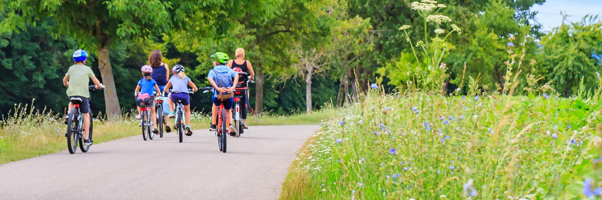
With almost 2,000m of altitude over 100km of route, the route is suitable for lovers of ascent, allowing a panoramic tour of the hills surrounding Salsomaggiore, in a succession of climbs and descents, among ancient pievi, castles and good wine. It starts from the spa town, (recommended free car parking in Via del Lavoro) the direction of Fidenza, you go down the Stirone Park and begin the ascent to Pellegrino Parmense, passing through Monte Salso and then descending towards Varano Marchesi to skirt (run alongside) the Ceno stream. Continue towards Fidenza via Pieve di Cusignano, Siccomonte and away to the last ascent to touch the village of Tabiano Castello and finally return to Salsomaggiore Terme.
The itinerary is not only a beautiful excursion for "trained legs" but also an adventure to discover the characteristic hilly landscapes of the "Food Valley"; Along the way there are cultivated fields, ancient villas, manors and farmhouses that produce the renowned agri-food excellences all over the world. It is pleasant to take a few stops to break the route and admire from the top of the hills the foothill valleys.
Elevation profile
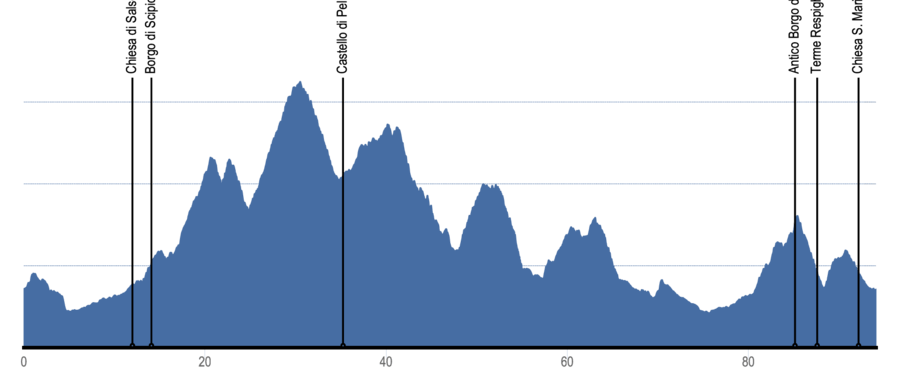
Crossed locations
- 1 Salsomaggiore Terme- Start 0,0 km
- 2 Montauro1,6 km
- 3 Lodesana5,1 km
- 4 Ponteghiara8,3 km
- 5 San Nicomede10,8 km
- 6 Scipione Ponte13,1 km
- 7 Salsomaggiore Terme15,0 km
- 8 Cangelasio16,9 km
- 9 Valico Pianazzo21,3 km
- 10 Grotta23,1 km
- 11 Pontegrosso24,8 km
- 12 Valico Sant’Antonio30,05 km
- 13 Pellegrino35,3 km
- 14 Mariano39,3 km
- 15 Case Boscaini40,4 km
- 16 Varano Marchesi47,8 km
- 17 Santa Lucia50,7 km
- 18 Case Barbieri51,8 km
- 19 Cella57,1 km
- 20 Gabbiano60,5 km
- 21 Pieve di Cusignano66,4 km
- 22 Costamezzana70,1 km
- 23 Santa Margherita76,2 km
- 24 Osteria del Sole79,8 km
- 25 Tabiano88,3 km
- 26 Salsomaggiore Terme- Arrivo 94,1 km
Itinerary highlights
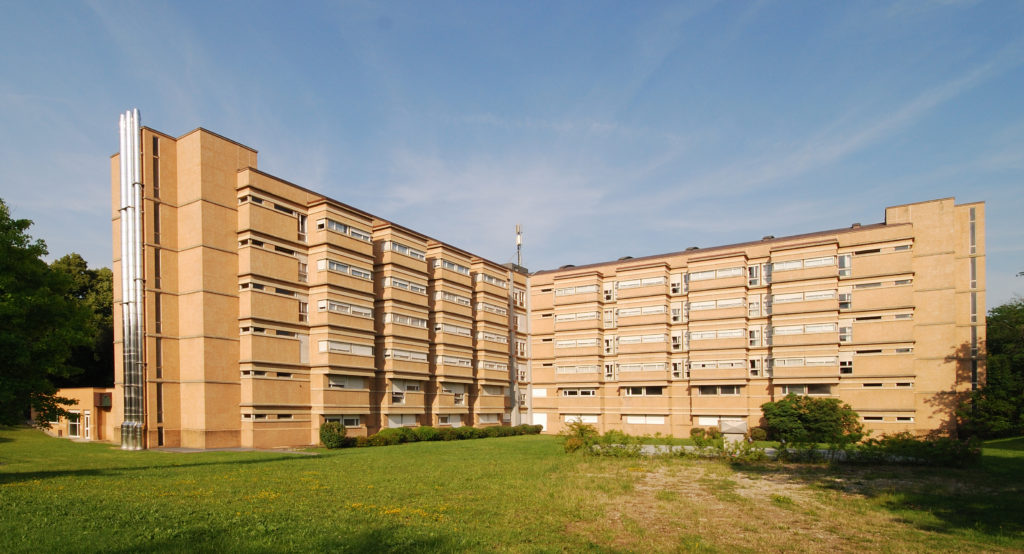
Modern Architecture - Luigi Zoja Thermal Spa
The modern building important for its medicinal facilities was inaugurated in 1970.
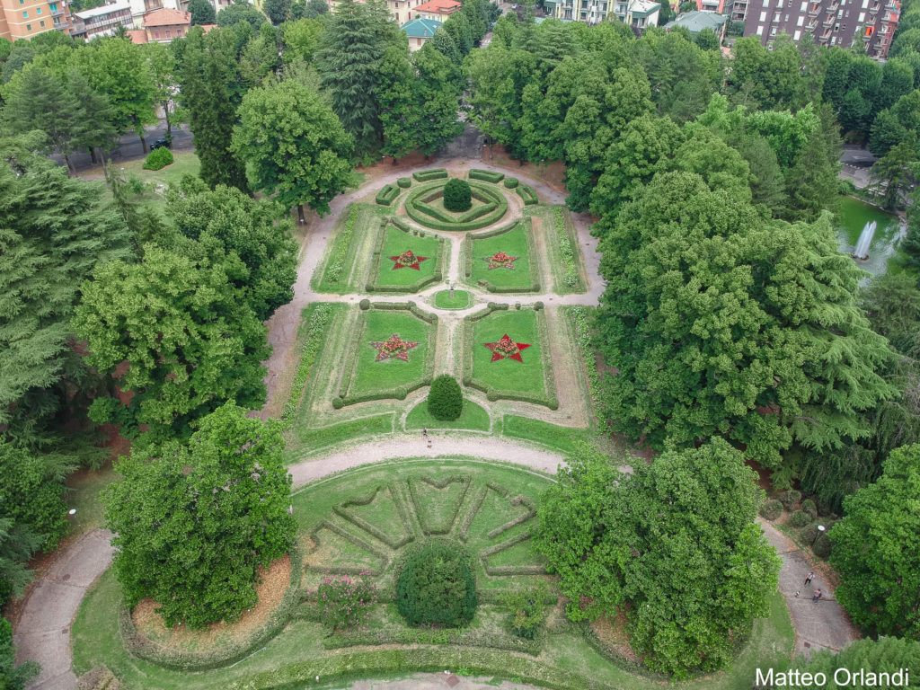
Urban Historic Gardens - Mazzini Park
Cultural Heritage of Emilia Romagna
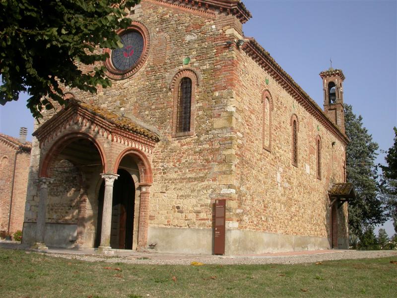
Parish Church of San Nicomede
The small church of St. Nicomede, preserves almost intact the Romanesque forms of the 12th century.