1 Salsomaggiore Terme
2 Tabiano Bagni
3 Santa Margherita
4 Pieve di Cusignano
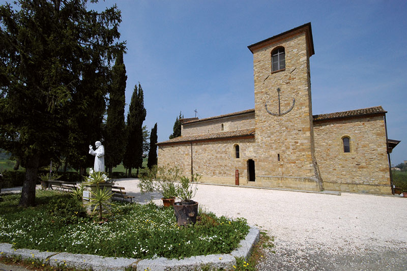
5 San Vittore
6 Piè di Via
7 Salsomaggiore Terme
The low-difficulty route is on paved road, it develops around Salsomaggiore through iconic places of the spa town such as Tabiano and Contignaco. It starts from the spa town, (recommended free car parking in Via del Lavoro) to climb up to Tabiano - at the top of the hill or with a small detour you can admire the Castle and the small Medieval Village. Continue in the direction of Fidenza; exited from Tabiano, downhill, you will meet, in the location of Cabriolo, the Romanic Pieve dedicated to St. Thomas Becket. Located along the Via Francigena, the route of pilgrims who led the travelers from Western Europe to Rome. Then from Santa Margherita proceed in the valley passing by Pieve di Cusignano to go back to San Vittore and return to the starting point. We recommend a small detour, a couple of off-track hairpin bends, to admire the Romanian Pieve of St. John in Contignaco and the Castle of Contignaco Fortress of the Aldighieri. Along the way, the tasting of bargnolino, a typical liqueur made from wild plum berries, is recommended. The Bargnolino or "Bargnulén" is counted among the De.C.O. Products. - Municipal designation of Origin.
Elevation profile
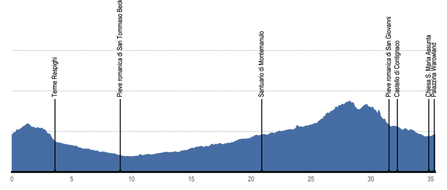
Crossed locations
- 1 Salsomaggiore Terme- start 0,0 km
- 2 Tabiano Bagni3,6 km
- 3 Santa Margherita12,2 km
- 4 Pieve di Cusignano19,5 km
- 5 San Vittore28,2 km
- 6 Piè di Via31,9 km
- 7 Salsomaggiore Terme- fine 35,3 km
Itinerary highlights
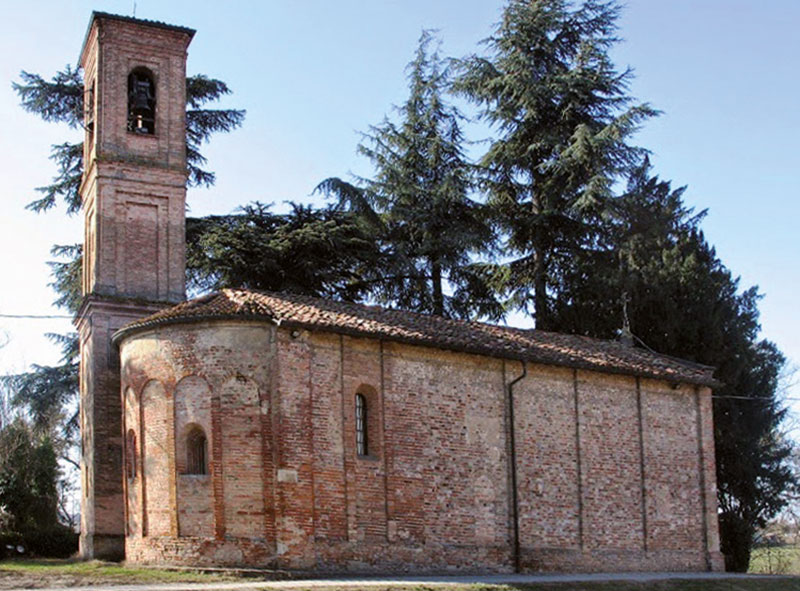
Cabriolo Parish Church - Fidenza
Walking on the Via Francigena – Places of the spirit and soul.
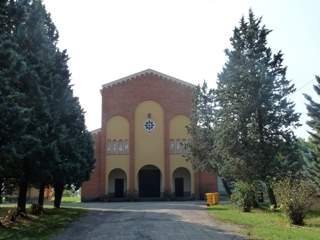
San Vittore Church
The church was initially called "Plebs Curticellis", a name that can be traced according to some sources to the name of the town of San Vittore in medieval times, "Corticelle", according to some hypotheses as it was included in one of the small courtyards in which the territory was divided.
San Giovanni in Contignaco Parish Church
On the top of the hill was built, in pre-Roman times, the church of St. John. Inside you can admire frescoes from the 14th and 15th centuries and pictorial testimonies of a singular local artist.
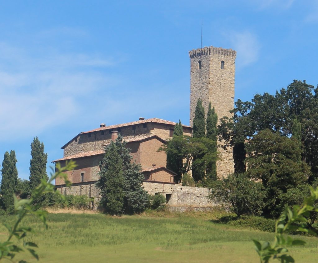
Castle of Contignaco, Aldighieri's Fortress
Adalberto Pallavicino built the fortress during the XI century and seems that its main tower 30 meters high was built in 1030.